


You are here
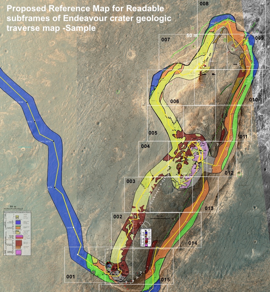
Sample Readable Scale Maps of Endeavour crater rim gelogic traverse
Publish Date:
Tuesday, November 12, 2019 - 10:30amBelow are some preliminary concepts for the presentation of the Endeavour crater geologic traverse maps. Conceptually, the products are simple polygons of successive areas alow the entire traverse. The final data set would consist of 90 to 100 subframes and the accompanying reference map.
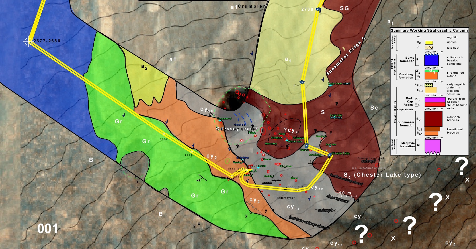
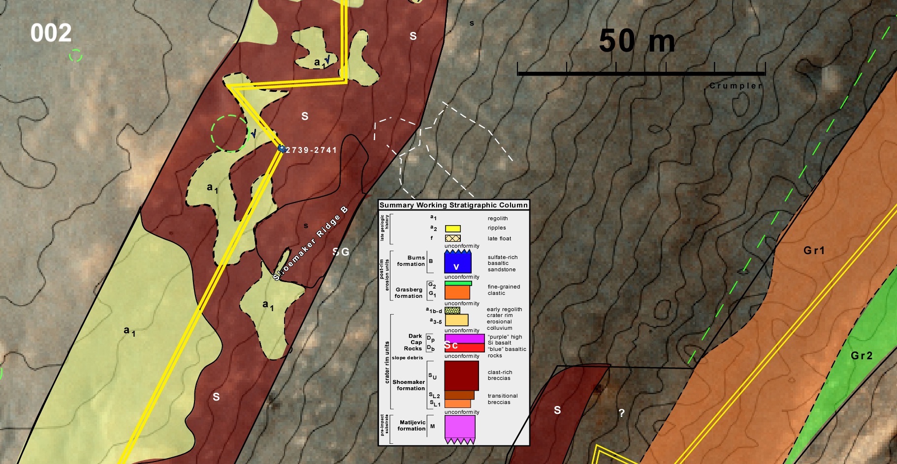
Cape York rim segment
data-href="http://www.nmnaturalhistory.org/node/1035"
data-layout="standard"
data-action="like"
data-show-faces="true">